August 2015

August 24th, 2015

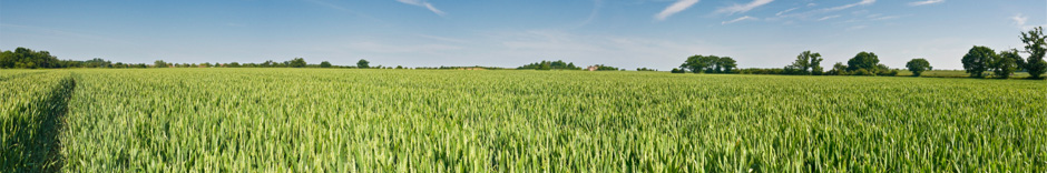
"With each passing year, human-caused global warming bullies California for more water. Each year, the heat squeezes more moisture from soils and ecosystems.


This is because, as the atmosphere warms, its demand for moisture rises. Just as a puddle evaporates more quickly on a warm day, soils dry out more quickly during warmer years, which are becoming increasingly frequent in most locations globally.


Currently, California is in the grips of a severe drought, which motivated my colleagues and me to conduct a study to determine how much of this drought can be blamed on natural climate variability. And how much can be blamed on the global warming shakedown? Our answer is 8-27 percent.


This finding, done using a model built on historical data, sheds light on California’s future and the effect higher temperatures have on the natural forces that drive California’s droughts.


California of buckets


Global warming is an emerging background effect on the year-to-year variations in drought caused by natural climate variations, such as El Niño and La Niña. This is especially true in California, where year-to-year precipitation varies wildly.


During most years, when natural climate variations cause wet or near-average conditions, the demands of the increasingly greedy atmosphere are still met with relative ease. During the last few years, however, natural climate variations have caused precipitation totals to be low and temperatures to be high.


Human-caused warming, meanwhile, demands additional atmospheric moisture, at a time when water resources for natural and human systems are already in short supply."


Read more from Newsweek.

August 6th, 2015

"Water containing so little dissolved oxygen that it can’t support marine life was found in an area stretching 6,474 square miles off the coast of Louisiana this summer.


At the size of Connecticut and Rhode Island combined, the dead zone is larger than last year’s 5,052 square miles and much larger than a national target, which was to reduce the annual size to just 1,900 square miles.


For decades, Louisiana Universities Marine Consortium’s Nancy Rabalais has done annual measurements of the dead zone size. A research cruise ran from Tuesday through Monday shows the dead zone extending from the mouth of the Mississippi River west to almost the state’s border with Texas.


“It’s a sick ecosystem. It’s still productive, but it’s ailing, and we need to do something about it,” Rabalais said.


The dead zone is defined as an area where the dissolved oxygen in the water measures 2 milligrams per liter, but this year, there were also large areas where the dissolved oxygen was 1 or even close to zero, Rabalais said. Healthy water in the Gulf of Mexico would measure about 4 or 5 milligrams per liter.


Dead zones occur when nutrients from agricultural land and cities run into the Mississippi River and then into the Gulf of Mexico. These nutrients, often included in fertilizers, feed small organisms that then use up oxygen as they die and decompose on the floor of the Gulf. Without any mixing of the upper freshwater layers from the Mississippi River and the lower saltier waters of the Gulf of Mexico, this lower layer of water can end up with such low oxygen levels that it can no longer support large amounts of marine life."


Read more from the Advocate.